When we left the rest area, we got back on the expressway and headed for the bridge. If you are from Michigan you know what that means. For the rest of you, “the bridge” means the Mackinac (pronounced MACK-in-awe) Bridge. The bridge is five miles long and opened in 1957–about eight weeks after I met Sylvia at a friend’s birthday party. You can learn more about the bridge here. This is an image from the official Website:
 |
| Aerial view of Mackinac Bridge — Lake Michigan on the left & Lake Huron on the right |
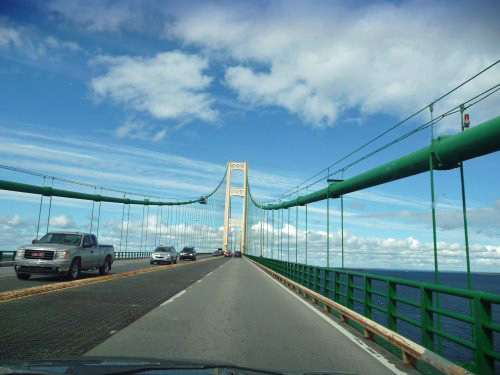
Soon, we could see the tops of the support towers above the trees. A slight turn, and we were on the south approach. Shortly after, we were on the center span.
 |
| Northward bound |
We still find this sight impressive. That green part of the roadway is a metal deck. It makes an interesting sound as you drive across.
 |
| Labor-Day weekend the bridge is open for walkers to cross the bridge |
All too soon we were across the span, had paid our toll and had turned onto Rt 2 west. This would take us along the edge of Lake Michigan. We spotted a scenic view and pulled in for a look and more photos.
 |
| Sylvia enjoys the brisk breeze with the bridge in the background |
I had just finished taking a photo of Sylvia, when a couple of women pulled in. They agreed to do a photo of us, if we’d do the same for them. Okay!
 |
| What a beautiful day–the rain came later |
Shortly after returning home, I discovered that our blogger friend, Sharky, had stopped at this same spot and taken a photo only a few hours earlier. Sorry we missed you.
We had been on the road for five and a half hours and driven 272 miles. We had another 70 miles to drive and would stop for supper before reaching our Day 1 destination.


